 Catalogo de metadatos del IGME
WMS (Web Map Service)
Type of resources
Available actions
Keywords
Contact for the resource
Provided by
Formats
status
Service types
-

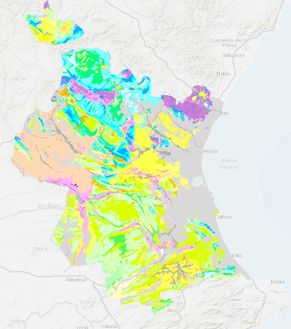
Mapa con las unidades cronolitoestratigráficas de la provincia de Alicante acompañado de fallas y estructuras de plegamiento. Forma parte de una síntesis geológica unificada de la Comunidad Valenciana.
-
The geological age map of the units at a scale of 1:1,000,000 has been generated from the information in the chronolithostratigraphic column of the map. In all units the System has been specified, the Series has only been covered in about half of the units and the Floor is occasional. In cases where it has not been possible to establish a chronostratigraphic section, the value "undetermined" has been assigned.
-
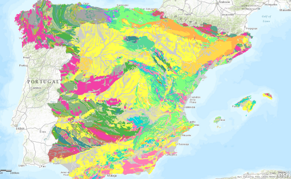
Map showing the chronolithostratigraphic units of the province of Valencia with faults and folding structures. It forms part of a unified geological synthesis of the Valencian Community.
-
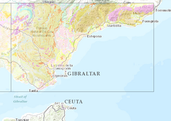
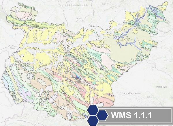
Map showing the chronolithostratigraphic units of the area covered by the sheet separated by different types of contacts: normal or concordant, discordant, intrusive and other. The tectonic structure is represented by the cartographic traces of folds, the orientation and dip of planar and linear elements contained in the rocks, as well as by the structural relationship - through faults and thrusts - between the cartographically differentiated rock assemblages. Unique features of the igneous rocks as well as the degree of migmatisation of the metamorphic rocks are also depicted. The map is accompanied by the lithostratigraphic legend and conventional signs.
-
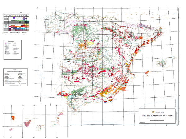
This map shows deposits dated as Plio-Pleistocene to contemporary, classified in 10 geochronological intervals and separated according to their genesis. Glacial, volcanic, karstic, aeolian, littoral, edaphic, palaeontological and prehistoric entities are included.
-
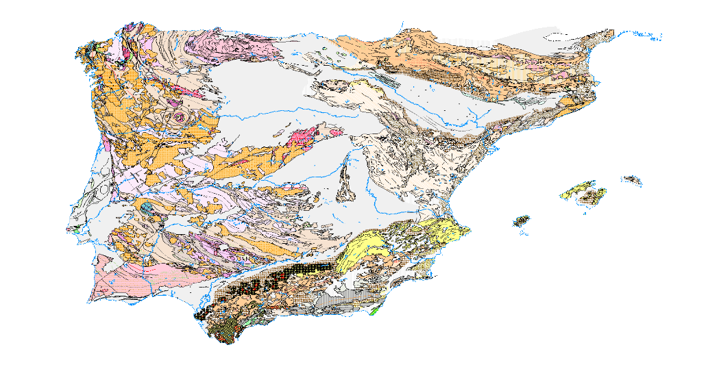
Visualisation service of the Tectonic Map in Spain at a scale of 1:1,000,000, of the Iberian Peninsula and Balearic Islands that identifies the major structural elements of the Earth's crust, and records the Earth's dynamism in the past.
-
Map with the chronolithostratigraphic and igneous units of the province of Badajoz grouped together as a support for the mapping of mineral resources in the province. The contacts between the different cartographic units have been classified as "stratigraphic contact" and "intrusive contact". The tectonic structure is expressed by faults.
-
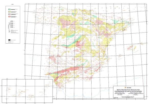
Map with the geographical distribution of the areas where similar expansivity is assumed for the clays, which have been classified into four groups: none to low, low to moderate, moderate to high and high to very high. The different mapped units have been assigned age (4 possible) and lithology (7 different types). The map also shows the surface formations without distinction.
-
The map shows a probabilistic identification of rockfall source areas for El Hierro Island, prepared with the combination of multiple statistical models
-
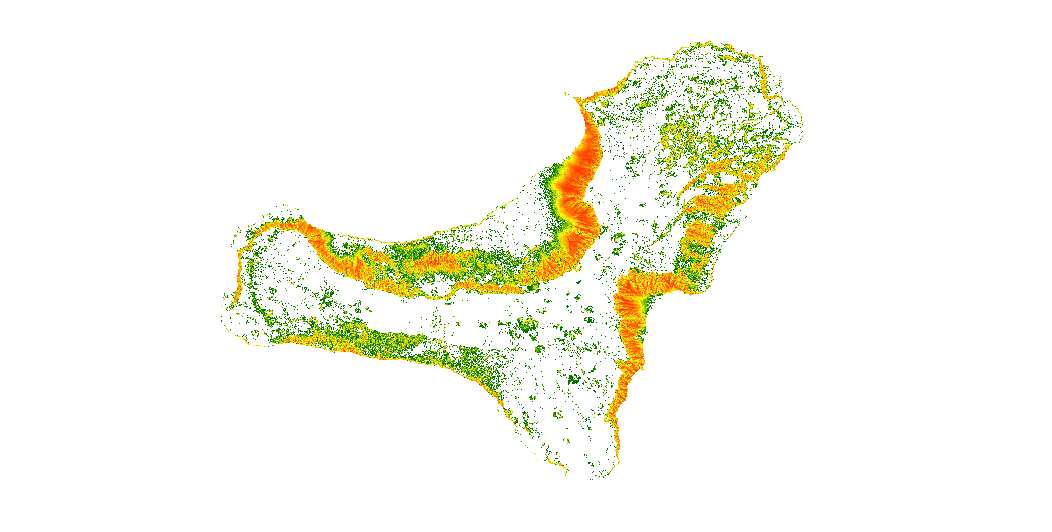
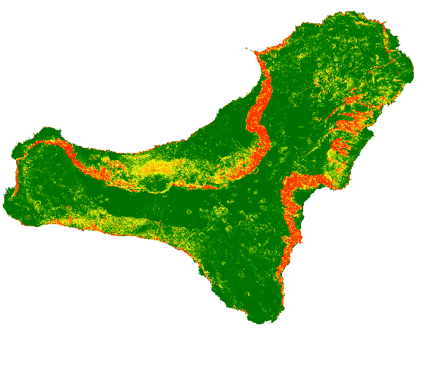
The map show the number of trajectories that pass through each pixel.